Regent Park's long process of redevelopment is bringing vast change to the neighbourhood.
But historic maps show that change is nothing new: the area has been rebuilt and tinkered with since the middle of the 19th century.
Use the slider to move the maps back and forth through the centuries.
The 1884 fire insurance map (right) shows the area partly developed, with small houses and open space between them:
In a later map from 1912, Regent Park has filled in to take on the urban form it would have until after the Second World War:
After the war, large parts of the neighbourhood, which suffered from miserable slum conditions, were torn down and redeveloped.
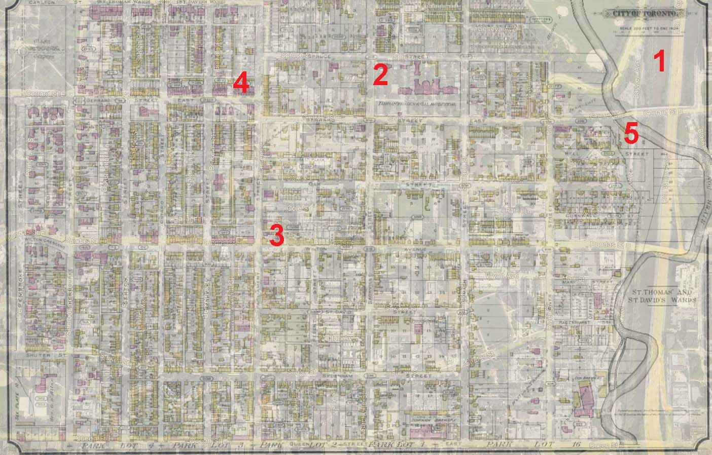
Here's what stands out in the 1884 map, overlaid on a modern satellite image (below):
1. The Don River still has its wiggly course. It was straightened a few years later in an effort to control water pollution and improve bridge access to the east side of the river.
2. The Toronto General Hospital was in Cabbagetown from the 1850s, at which time it would have been a little outside the city, until 1913. It was then pressed into wartime service as barracks.
3. If Wilton Avenue sounds unfamiliar, that's because it's now Dundas Street East. The Dundas Street that we know is the product of a traffic reorganization project in the 1950s that linked several otherwise unconnected streets and renamed them. (These forgone street names could offer one solution to the modern debate about renaming things and places named after Henry Dundas.)
4. If the Gerrard and Parliament intersection seems awkward now for east-west travel — it used to be even more more awkward.
5. Until the Don River straightening project (and, later, the Bloor-Danforth viaduct), there were few good bridges across the Don north of Queen Street East. The ones that were in place were prone to being washed out.

