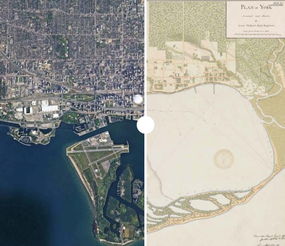
Empires run on maps, and in 1818 Lieutenant George Philpott of the British Royal Engineers was a businesslike servant of empire.
Philpott's "Plan of York" is the earliest high-quality map of the city that later became Toronto.
Over two centuries later, it's hard to know whether any details escaped his attention, but the map's level of precision makes that seem unlikely. To wit: the map's survey is so intricate it even shows the areas of residential lots that were used as gardens.
The Plan of York reveals that in 1818 the natural landscape was still more or less unchanged by European settlement — though that would later change.
It also shows the beginnings of a relentless grid representing system and control.
Millions of tons of steel and concrete later, the original place is still quite recognizable.
Use the slider to move the map back and forth through the centuries.
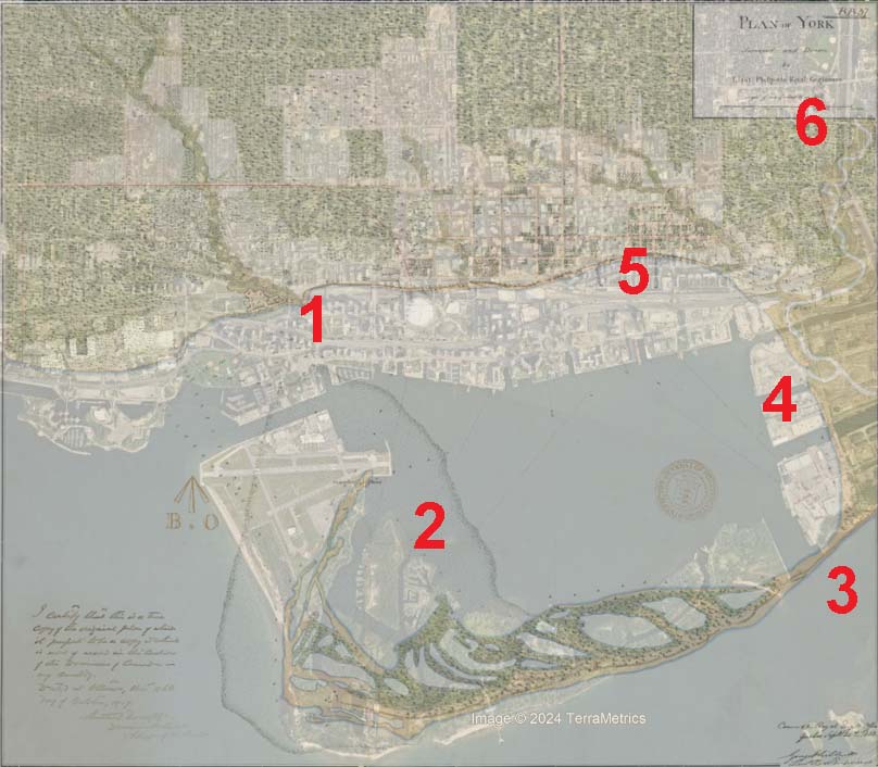
Here are six things we learned from overlaying the 1818 map on the modern City of Toronto (below):
1. It takes an effort of imagination to see now, but Fort York was originally on the shoreline. The historic site is now separated from the water by the Gardiner Expressway, Lakeshore Boulevard, Coronation Park and Billy Bishop Airport's entrance building.
2. The place we know as the Toronto Islands was once a marshy sandbar. That land was later expanded by the city. This 1815 chart shows more clearly how shallow the area that's now the Island airport once was.
3. While there is a long-running debate in modern day Toronto about whether to build a pedestrian bridge to the Islands, in 1818 residents could have easily walked on to the landmass. A violent storm in 1858 separated the peninsula from the mainland.
4. The Ashbridges Bay marsh was filled in in the early 20th century, a process that is being partially reversed as the Don Mouth redevelopment project restores some natural features to the area, like a river bed that has a more wiggly course.
5. Toronto’s natural shoreline is surprisingly far north: Front Street was the original waterfront. The shoreline of 1818 was a gentle, gradual slope, so fill was needed to allow ships to dock. Starting in the 1850s, the city started to fill the shallow water and expand to the south. The little slope of hill south of Front Street in this engraving from the 1850s is still quite familiar in the modern downtown, but in that era it led directly to the shore.
6. The Don River was straightened in the 1880s, part of an effort to clear polluted water more efficiently and control flooding.

